Maps
-
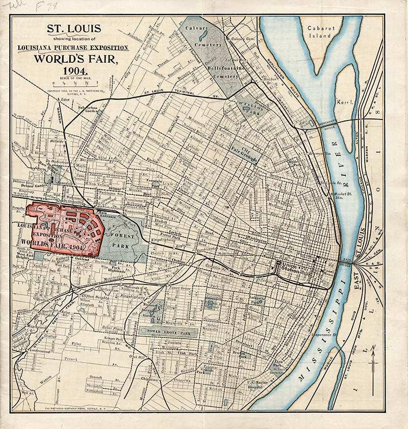
Map : St. Louis showing location of Louisiana Purchase Exposition, World's Fair 1904
-
St. Louis World's Fair : Louisiana Purchase Exposition, May to December, 1904
1 map : 20 x 31 cm. on sheet 26 x 39 cm. Contents: Includes index of buildings and exhibits.
-
View of grounds looking west, Louisiana Purchase Exposition, St. Louis, Mo.
-
View of of Louisiana Purchase Exposition fairgrounds
-
Birds-eye view of the Louisiana Purchase Exposition grounds
-
Bird's eye view of the World's Fair 1904
Shows building locations from southeast entrance.
-
Birdseye view, World's Fair, St. Louis
-
Card : Map of the United States showing Louisiana Purchase of 1803
-
Ground plan of Louisiana Purchase Exposition, St. Louis, Mo., 1904
1 map : 33 x 46 cm. on sheet 37 x 52 cm. Contents: Includes index of buildings and exhibits. Other contributor(s): D.R. Francis, President ; Isaac S. Taylor, Director of Works ; O. Schrowang.
-
Index to location of amusement features on The Pike
-
Leaflet : Bird's-eye view of Louisiana Purchase Exposition
 View Image
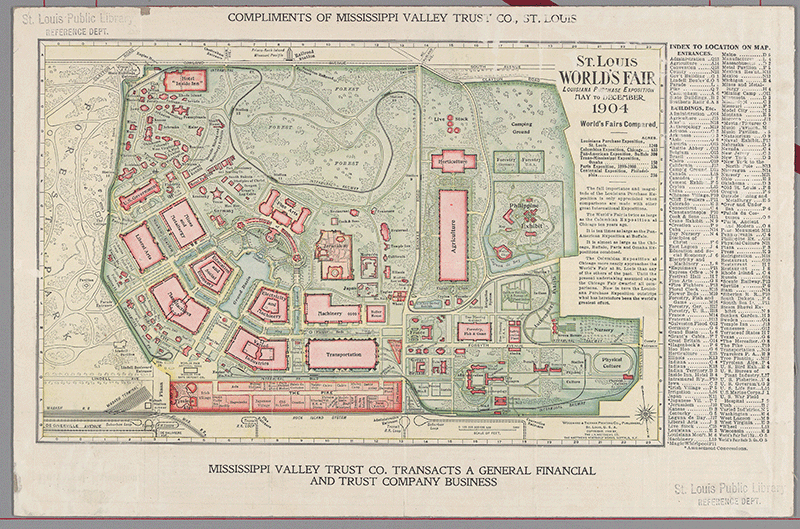 View Image
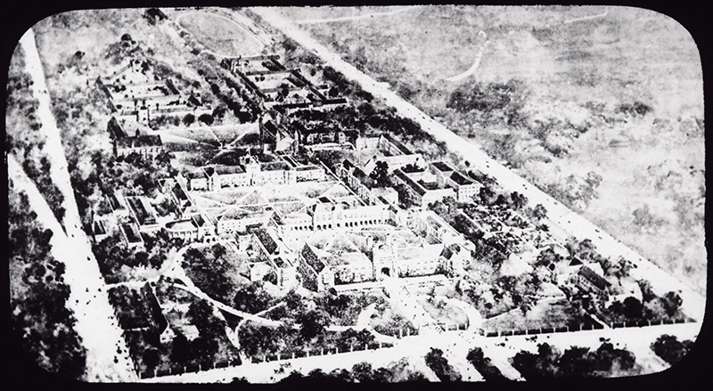 View Image
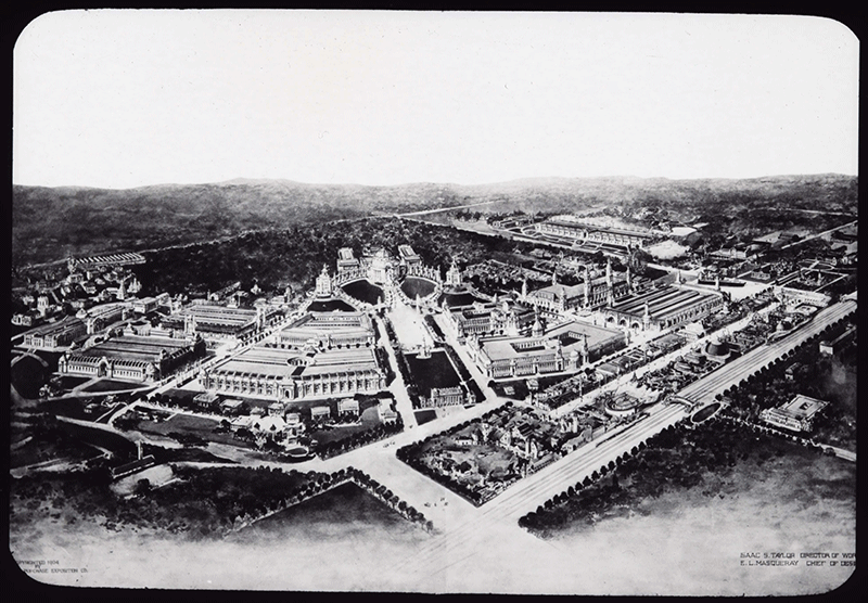 View Image
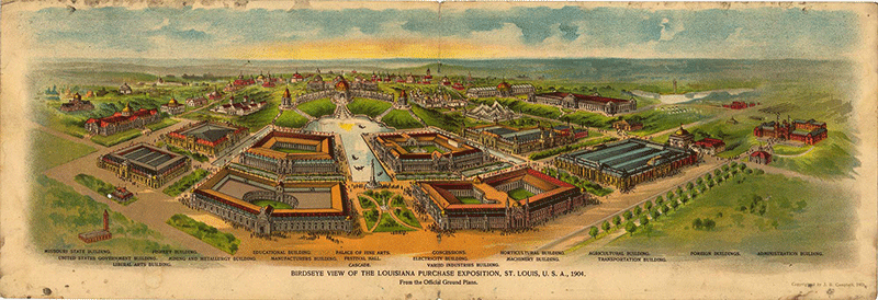 View Image
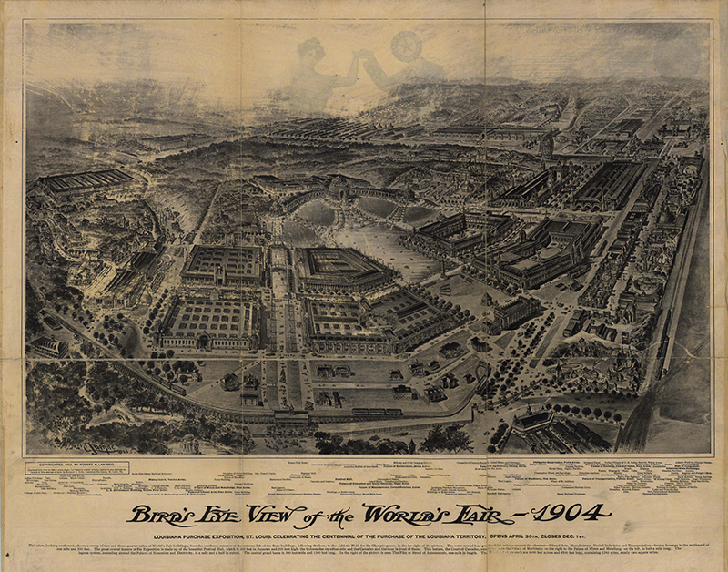 View Image
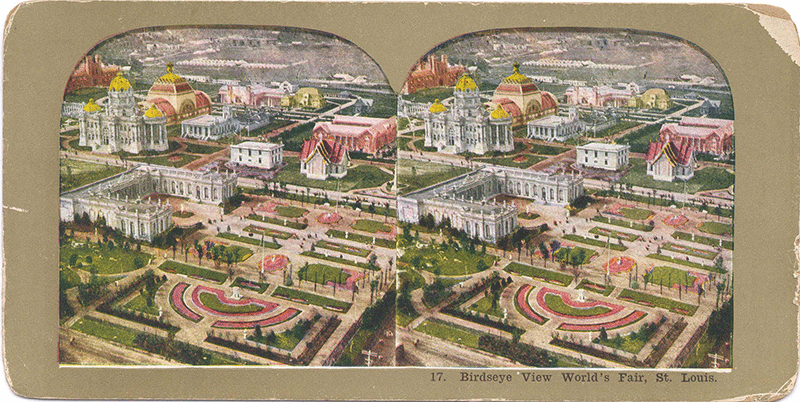 View Image
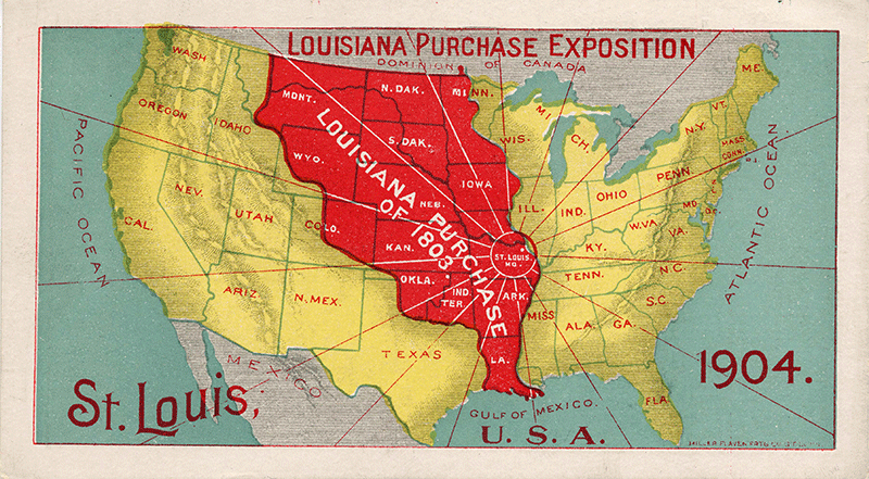 View Image
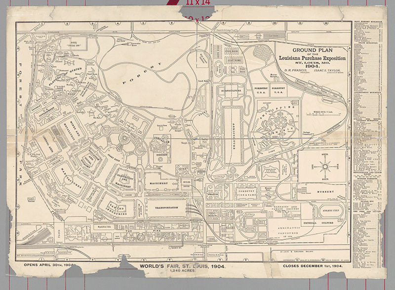 View Image
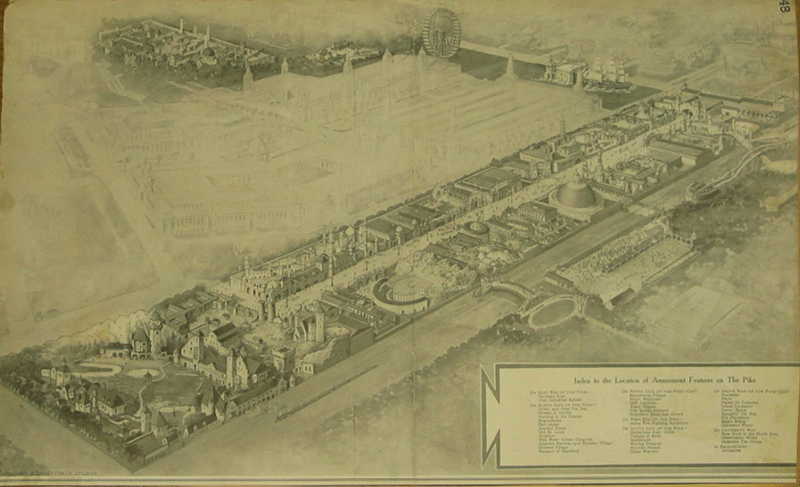 View Image
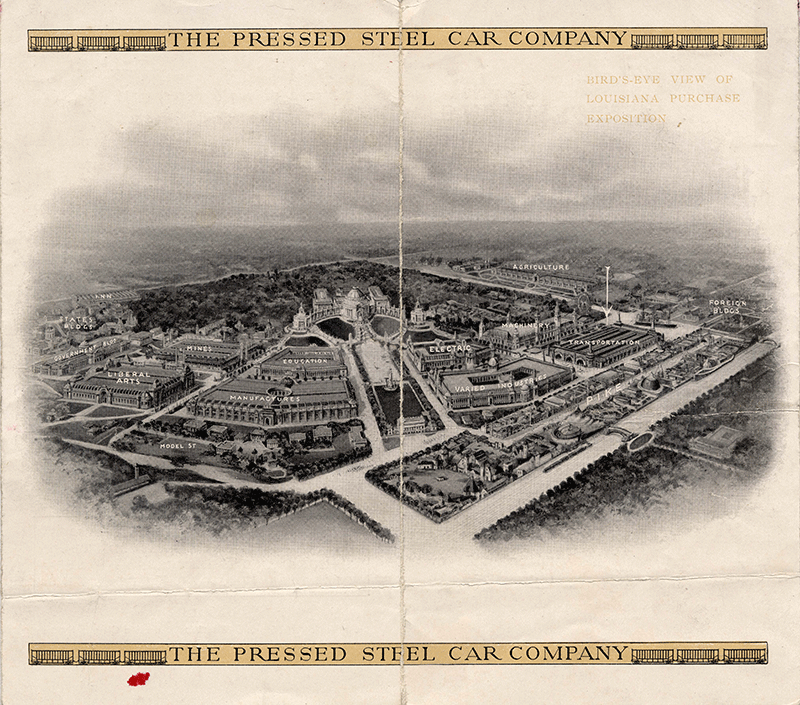 View Image